User Interface - Beyond the Command Line


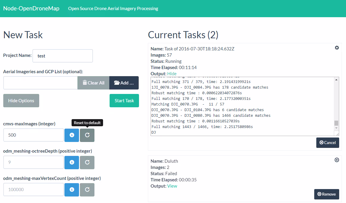
OpenDroneMap started as a command line program. This sets the bar unreasonably high for new users, so for some time a graphical interface has been on the wish list for OpenDroneMap.
node-OpenDroneMap and WebODM have become the core projects in the development of web development for OpenDroneMap in order to provide a graphical interface. node-OpenDroneMap provides an internal Application Programming Interface to the OpenDroneMap system. As such, it is the glue between any user interface, such as via the web, and Core OpenDroneMap software. WebODM is a web interface that enables users to upload images, easily process imagery, and view the results of that processing from OpenDroneMap. It also provides an API for future projects, creating the potential for e.g. phone apps that can upload and process imagery or a future QGIS plugin.
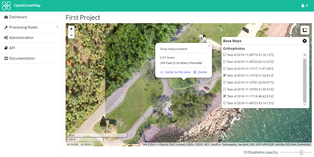
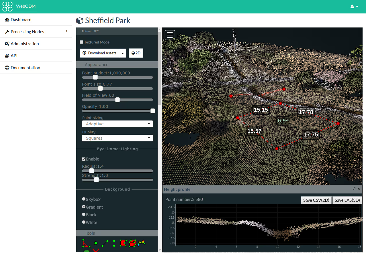
WebODM is under rapid development, recently additional allowance has been created for advanced interaction with the 3D point clouds and meshes that OpenDroneMap produces, allowing for measurements to be taken directly on the models.
Next steps include interfaces for creating and using ground control point files.
Stay updated
Sign up for our newsletter to receive regular updates on resources, news, and insights like this. Don’t miss out on important information that can help you stay informed and engaged.


Explore Elrha
Learn more about our mission, the organisations we support, and the resources we provide to drive research and innovation in humanitarian response.