


Digital Technologies in Nepal’s 2026 Flood Response: Evidence and Lessons
Project overview
This study explores how digital and emerging technologies were used during Nepal’s 2026 Rasuwa–Bhotekoshi flood response, examining their operational contributions, coordination challenges and lessons to recommend more effective, coordinated and responsible technology use in future disasters.
Project solution
This project offers [specific solution or intervention] to tackle [challenge]. By implementing [strategies, tools, or innovations], the project aims to achieve [desired outcomes]. The approach is designed to [specific actions or methods] to bring about meaningful change in [community, region, or issue area].
Expected outcomes
This project aims to achieve [specific outcomes], such as [measurable results, improvements, or changes]. The expected impact includes [benefits to the target community, advancements in research or innovation, or long-term effects]. By the end of the project, we anticipate [specific changes or milestones] that will contribute to [broader goals or objectives].
Purpose
This study will examine how digital tools, data systems and emerging technologies were used during Nepal’s 2026 flood response, how they contributed to operational decisions, and what can be learned for recovery and future emergencies. It will map the organisations and technologies involved and examine how selected technologies moved from deployment and data generation through to decision-making and action.
The project will also help ensure lessons from the 2026 response inform how agencies and technical communities work together during future disasters. It will convene government and non-government responders, drone pilots, geospatial specialists, humanitarian organisations and local innovators to examine how technology was requested and deployed, where duplication occured, and how coordination, approvals, data sharing and analysis could be improved. Relevant stakeholders will review findings and proposed guidance, which will be shared in accessible formats to support institutional learning and preparedness.
Expected Outcomes
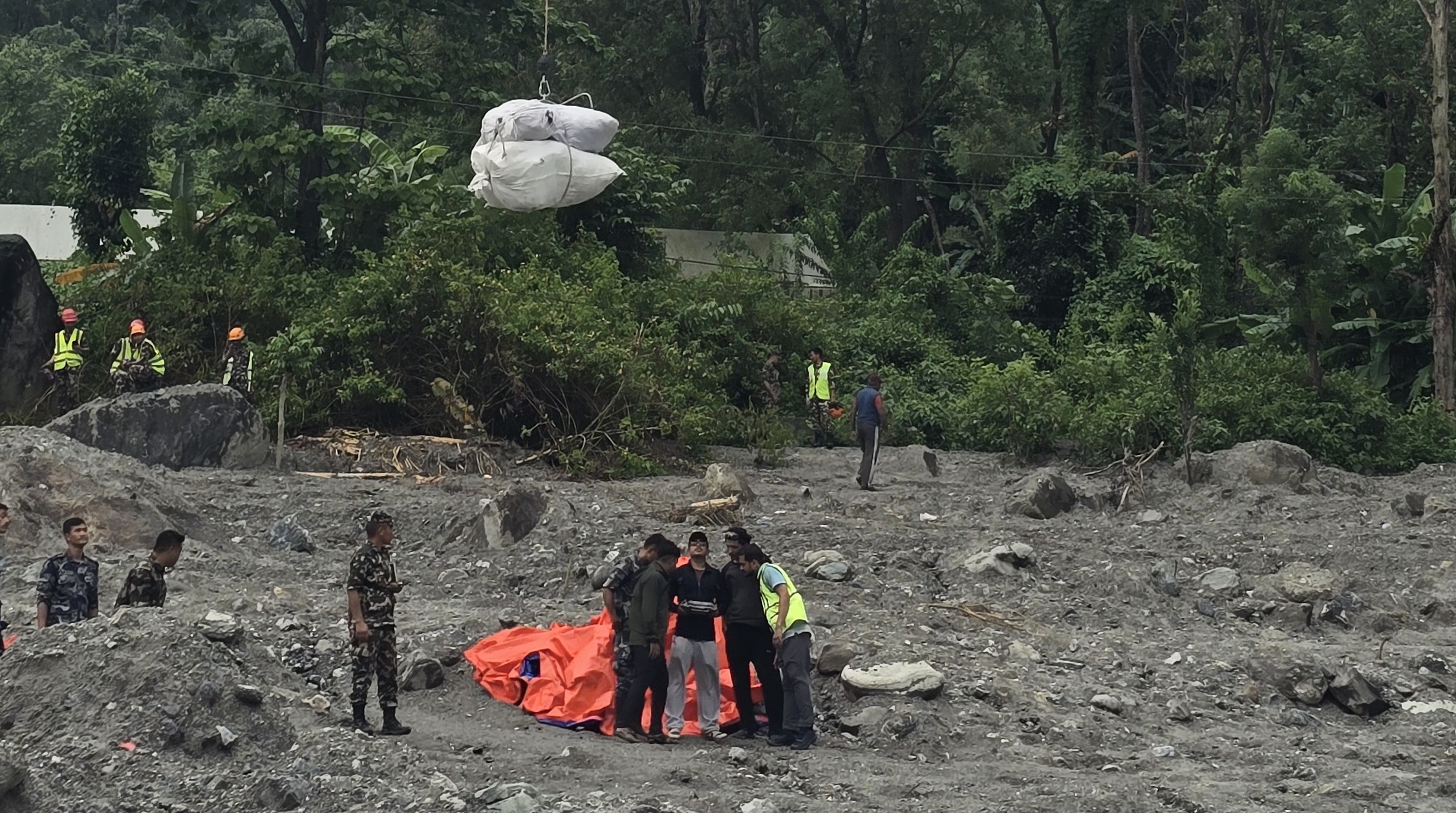
The study will document how government agencies, humanitarian organisations, local specialists and volunteers used technologies across early warning, rapid response and initial recovery during Nepal’s 2026 flood, identifying who did what, how deployments worked, the challenges faced and lessons learned. It will examine applications ranging from drones, satellite imagery and AI-assisted damage mapping to search and rescue, cargo delivery and, where documented, forensic DNA profiling for identifying human remains.
A verified technology inventory, use-case catalogue, operational case studies and synthesis report will document both direct field contributions and how information informed decisions. Standard operating procedures for drones and satellite imagery will propose clearer approaches to activation, tasking, approvals, data sharing, validation and responsible AI use.
The findings aim to reduce duplicated assessments, strengthen coordination among responders and institutions, and support recovery, reconstruction and future disaster preparedness and response.
Since Nepal’s 2015 earthquake, we have seen drones and geospatial data used in disaster response. During the 2026 floods, more than a dozen drone pilots supported operations ranging from search and rescue to damage mapping. We need to document these efforts and develop guidelines for better coordination
Uttam Pudsaini, Principal Investigator
Project delivery & updates
Stay up to date with the latest developments from this project. Here, you will find details on what has been delivered, resources created, and regular updates as the project progresses. Access key documents, reports, and other materials to see how the project is making an impact.