
The Global Development Community calls for better access to imagery and data


On February 21st 2017, a new initiative was launched in response to calls by the Global Development Community ‘for better access to imagery and data, which can fuel greater analysis and insight into the various challenges facing societies across the globe’. One hundred leading international geospatial and development experts, supported by the Bill &; Melinda Gates Foundation and Omidyar Network, met to imagine how open imagery, tools, and strategies could be harnessed to meet some of the world’s most urgent challenges.
Francis Gassert, Data for Impact Lead at World Resources Institute noted: “NGOs lack the capacity to navigate the world of satellite and airborne imagery“.
Andrew Schroeder, Director of Research and Analysis at Direct Relief, specializing in ‘solving local challenges and needs using robotics and artificial intelligence technologies’ commented :
“The world has no time to lose. The interconnection of the world means that crises are moving faster. We need the necessary tools to counter the intersecting and overwhelming calamities and challenges that we are facing collectively.”
Peter Rabley, Venture Partner and Property Rights lead at Omidyar Network highlighted the opportunity: “Continued advances in geospatial science, particularly in terms of the growing volume, increasing temporal frequency, and spatial and spectral resolutions of remotely sensed imagery provides enormous opportunities for the international development community”
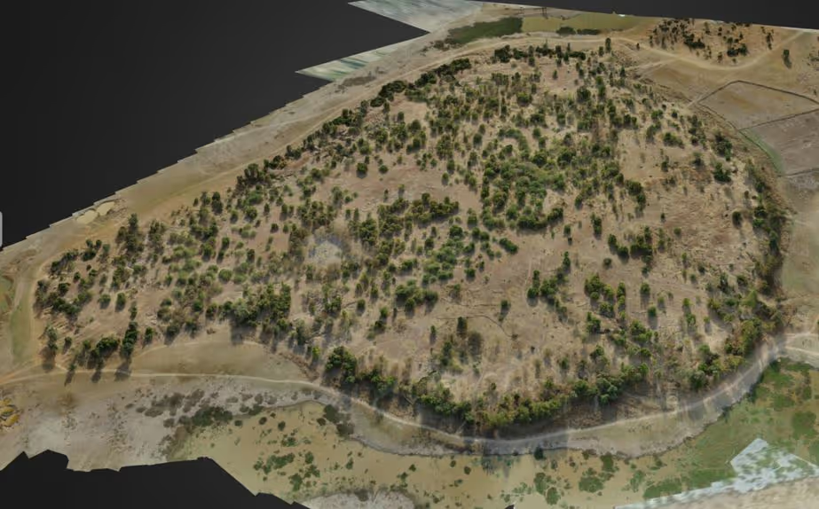
There were calls for ‘continuous inclusion of, and leadership from, the global development community and the development of ‘Best-Practice, use-cases, and use-case analysis’. The mCubed survey of Djenné-Djenno in Mali is a good illustration of the opportunity Peter Rabley was referring to when he talked of the advances in ‘temporal frequency, and spatial and spectral resolutions’ of aerial surveys.
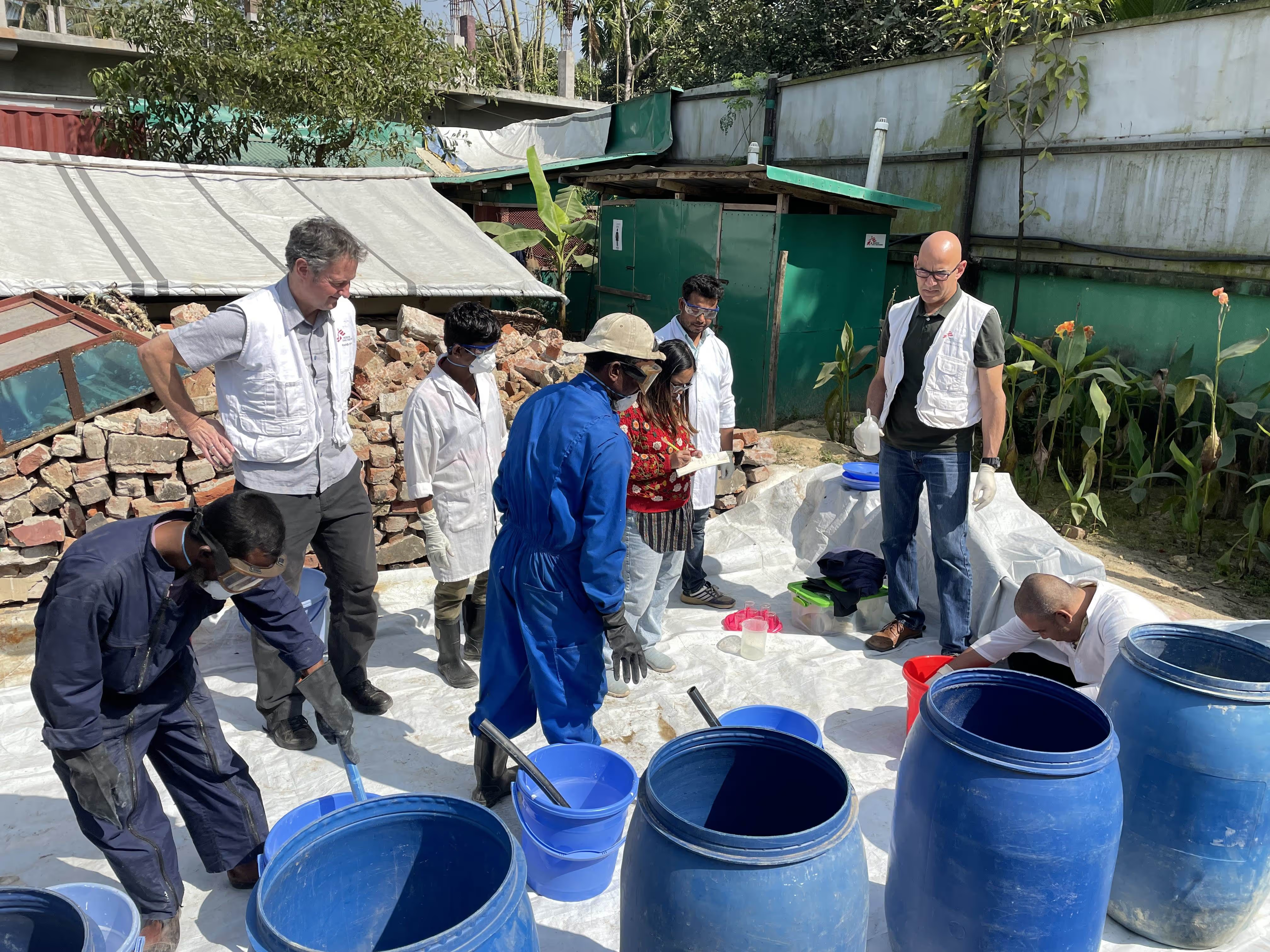
We have already explored how drone based surveys can complement satellite imagery with their higher resolution in this blog; and ease of deployment and involvement of local communities in this video.

Djenné-Djenno was chosen given its importance in the field of heritage stewardship. The World Monuments Fund highlighted the value of the Djenné-Djenno UNESCO world heritage site to world history: ‘Djenné-Djenno’s many archaeological and cultural artefacts reveal a complex society dating from 250 B.C. It is among the best-known archaeology sites in sub-Saharan Africa and the oldest urbanized centres. Less than three kilometres southeast of the modern village of Djenné, Djenné-Djenno was abandoned by the sixteenth century, and remained undiscovered until the 1970s.
Looters in search of antiquities dug massive trenches, which led to flooding. In one of its many efforts to preserve the site, the Mali government established the Mission Culturelle à Djenné in 1993, but looters in search of the astonishing terracotta figurines of humans and animals continued to cause damage, disturb soil, and cause water erosion. While looting was curtailed by a major education initiative through the Mission Culturelle and by protections of UNESCO, which inscribed Djenné-Djenno as a World Heritage Site, the environmental damage was not reversed.’
M.Coulibaly, Chef du Mission Culturelle, Mali commented at the recent UNESCO sponsored workshop in Timbuktu " Nous avons besoin de cartographier toutes les sites archeologiques et de Patrimoine mais nous n'avons pas les moyens".
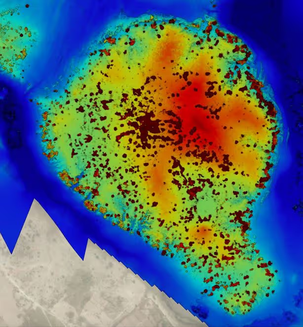
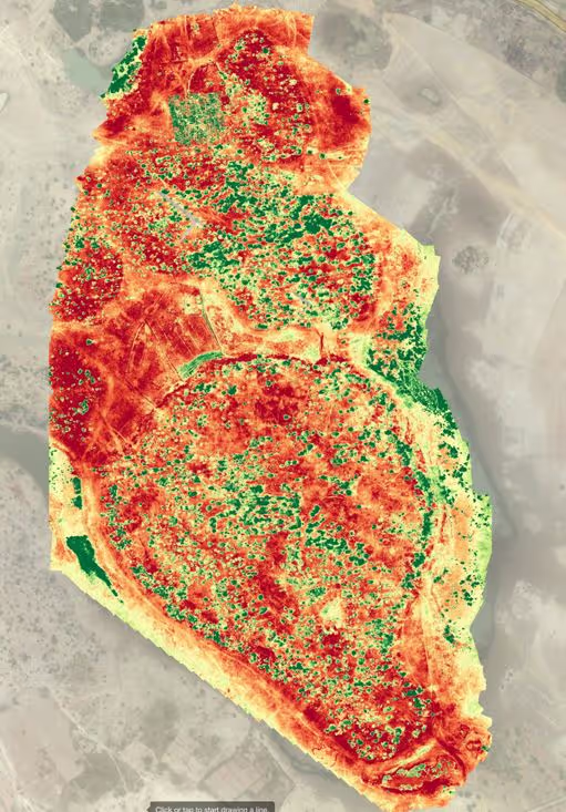
Now, with the insurgency in Mali such sites are once more endangered by their remoteness, economic collapse and the illegal trade in antiquities. After no effective monitoring of the site for years, mCubed was able to map and model the site, and show how photogrammetry can be used to create a detailed map of elevations, and spectral analysis could be used to show never seen before archaeological detail.
The Initiative received the support from both the Minister of Tourism and Minister of Culture. But even more important, this HIF supported project has shown the wider applications of this approach. These include infrastructure monitoring and maintenance, so critical when the roads and bridges can be a life line to the peacekeeping operations. Another application area is Surface Water Drainage (SWD) which HIF highlighted as an area, which despite its significant impact on health and wellbeing is often neglected in humanitarian contexts such as refugee camps. The Minister for Higher Education and Scientific Research in Mali, Prof. Assetou Foune Samake Migan, saw the greatest benefits coming from applying this approach for crop monitoring to improve the productivity of the agricultural sector and food security within the country.
This use case from Djenne Djenno as well as the broader applications suggests that the rationale behind the meeting of international geospatial and development experts convened by the Bill &; Melinda Gates Foundation and Omidyar Network, as well as HIF’s support for this project was timely and highly significant to the field of humanitarian innovation.
Stay updated
Sign up for our newsletter to receive regular updates on resources, news, and insights like this. Don’t miss out on important information that can help you stay informed and engaged.

Related articles


Explore Elrha
Learn more about our mission, the organisations we support, and the resources we provide to drive research and innovation in humanitarian response.