Fast‚ accurate‚ easy‚ scalable processing of drone imagery


The detailed, cloud-free view that unmanned aerial vehicles (UAVs) provide is useful for disaster preparedness. It has great potential for field tactics (e.g. determining the best possible route for a convoy), and is useful for allocation of resources for relief coordination (e.g. damage assessment and determining most affected areas). Additionally, processed UAV imagery can result in a unique additional product—three dimensional (3D) point clouds, digital surface models, and digital elevation models—required for natural disaster preparedness planning, and societal and infrastructure vulnerability assessments.
The Humanitarian UAV Network, UAViators site lists the following use cases for UAV imagery in the humanitarian context:
- Rapid assessment of disaster damage to building infrastructure;
- Rapid assessment of powerlines and other electricity infrastructure;
- Identify usable roads and transportation infrastructure;
- Identify useful areas for humanitarians to set up base camp;
- Aerial support for road clearance activities;
- Estimate population displacement;
- Identify temporary shelters and locations to set up new shelters;
- Survey impact of disaster on agriculture, farmland;
- Search and Rescue.
Evidence of need for UAVs in humanitarian crises can be found in the ongoing work by Humanitarian OpenStreetMap Team in implementing and deploying OpenAerialMap (OAM) and OpenImageryNetwork (OIN).
For Cristiano Giovando, in his post “Access to open imagery: Innovation”, OAM and OIN are an extension of existing work using other imagery for disaster response mapping. OAM and OIN necessarily address the problem of finding and using satellite, manned aircraft, and UAV imagery.
“Imagery from satellites, Unmanned Aerial Vehicles (UAVs) and other aircraft is being generated more and more, however after a disaster it is difficult for aid workers to determine what imagery is available and where to access it. OpenAerialMap (OAM) seeks to solve this by providing a simple, open way to process and provide imagery for humanitarian response and disaster preparedness.” - Cristiano Giovando
Another use case for small UAV imagery is the Missing Maps project.
Missing Maps www.missingmaps.org, founded by Medecins Sans Frontieres (MSF), the British Red Cross, the American Red Cross, and the Humanitarian OpenStreetMap Team seeks “to map the most vulnerable places in the developing world, in order that international and local NGOs and individuals can use the maps and data to better respond to crises affecting the areas.”
The Missing Maps project was established to map vulnerable places and populations ahead of humanitarian crises in order to better inform humanitarian response at the outset of a crisis.
MSF, as a partner in the OpenDroneMap consortium, is particularly concerned about areas where traditional sources of imagery are often incomplete or of very low quality. This is because in many particularly vulnerable locations up-to-date, cloud-free imagery is not available, and without the incentive of an existing crisis, it is less likely that satellite imagery providers allocate satellite resources. OpenDroneMap will allow local and international partners to engage in localized and cloud-free mapping exercises independent of satellite and manned aircraft provisioning and in support of Missing Maps.
Relative to UAV imagery use, the technology gap common to UAViators, OpenAerialMap, and Missing Maps is the processing of imagery from UAV platforms into geographic data.
OpenDroneMap is an open source toolkit for processing UAV imagery.
Typical small UAVs use simple point-and-shoot cameras. OpenDroneMap turns those simple images into three dimensional geographic data that can be used in combination with other geographic datasets. In this proposal, we seek to advance the innovative trajectory of the OpenDroneMap (ODM) project to close the gap between UAV acquisition and imagery dissemination; in other words, between the work of the UAViators, HOT’s OpenAerialMap project, and the Missing Maps initiative.
The aim of this Humanitarian Innovation Fund project is to advance the state of the art with respect to the use of OpenDroneMap in the humanitarian context in 4 areas:
- improve usability
- improve and validate data quality
- integrate with existing humanitarian tools
- improve the scalability of OpenDroneMap.
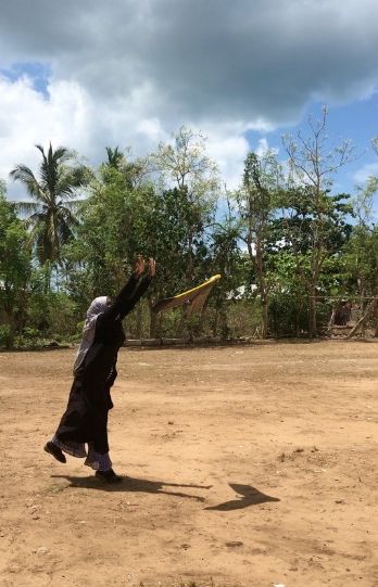
Feature Photo Caption: Khadija Abdula Ali flying drones for the Zanzibar Mapping Initiative, near Unguju Ukuu, Zanzibar, Tanzania
Stay updated
Sign up for our newsletter to receive regular updates on resources, news, and insights like this. Don’t miss out on important information that can help you stay informed and engaged.


Explore Elrha
Learn more about our mission, the organisations we support, and the resources we provide to drive research and innovation in humanitarian response.